
CONSTRUCTION ENGINEERING
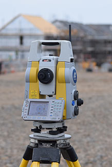
With 30 years site experience we provide a first class service to our clients in civil engineering, renewable energy, building construction and oil & gas industries. Using either robotic total station, survey grade GNSS or 3D laser scan survey equipment on site we provide efficient and high quality site engineering setting out and site surveys. We are fully aware how vital this trade is to ensuring construction site operations run smoothly and profitably.
RAILWAY ENGINEERING & SURVEYS
PTS qualified engineer for setting out, survey and laser scanning on rail projects, most recently the HEP project in Scottish highlands
3D LASER SCANNING SURVEYS
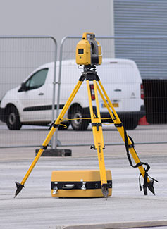
3D laser scanning is a cost effective, safe, rapid, detailed, non contact measurement process, and as such is the perfect process for mass data collection and surveying awkward areas for example; cliff erosion, slope stability, quarry face update, live trafficked roads, flood risk areas, building elevations, high-rise buildings, historic & archeological sites, bridges and viaducts, tunnels and dams. We supply laser scanner hire with surveyor, and process scan data to produce 3D point cloud with Topcon Scanmaster3 and Magnet Collage softwares for architects, engineering consultancies, contractors and clients. Scan data pointcloud is typically imported by client into Autodesk Revit or viewed in Topcon Scanmaster or Autodesk Recap viewer software [both viewers free to download]. Via www.uklaserscan.co.uk we offer a UK wide service, please contact us to discuss your requirements and visit www.uklaserscan.co.uk . Our laser scanners are class1 laser safe products.
TOPOGRAPHICAL LAND SURVEYS
We can provide detailed topographical land surveys, measured building surveys, utility surveys, site engineering surveys, quarry surveys, GPS surveys. On site we utilise Topcon realtime kinetic GNSS and/or 1" or 5" robotic total stations then later in office we process all survey data to drawings and 3D terrain models with AIC n4ce Designer software. Surveys can be either to UK OS national grid or local grid co-ordinate systems. We offer a UK wide service please contact us to discuss your requirements.
MEASURED BUILDING SURVEYS & AS-BUILTS
We can check your site as work progresses or on completion `as-built` surveys using robotic total stations, precise dumpy levels, laser scanner, or GPS equipment and process your survey data into various digiital drawing formats eg. DWG, DXF, PDF, E57, LAS, ISOPACHYTE, POINTCLOUD, and/or produce volume report, as-built report, monitoring report etc. Utilsing 3D laser scanners we can safely survey your site and produce building floor plans, elevations and sections.